The problem
The Abbey of Santa Maria della Vittoria in Scurcola Marsicana is a 13th-century Cistercian complex, today largely in ruins. The regional heritage authority (Soprintendenza Archeologia Belle Arti e Paesaggio) needed digital documentation of the site that would do three things at once: guide restoration, support archaeological study, and let people who cannot visit get to know the place. Traditional survey was impractical: the complex is large, vegetation has taken over, and several areas are closed for safety.
The survey
We used three instruments because none was enough on its own. The drone produced 700 photographs of roofs, courtyards and the surrounding ground. From the ground we shot another 400 photos at 61 megapixels for masonry, architectural details and decoration, at sub-millimetre resolution. A FARO Orbis laser scanner made 4 high-density scans of the main interiors and structural joints: that is the reference geometry we anchored the photogrammetric models to.
It took several sessions to fit around weather and access permits, with a survey team and a heritage documentation specialist on site.
Processing
Everything was aligned and processed in Agisoft Metashape Pro, from more than 1 TB of raw data, into a single point cloud. From there we delivered two things: high-resolution orthophotos of every facade and structural surface, which are the metric base restorers draw their interventions on, and a simplified 3D model of the ruins, intended as the geometric skeleton for a historical reconstruction.
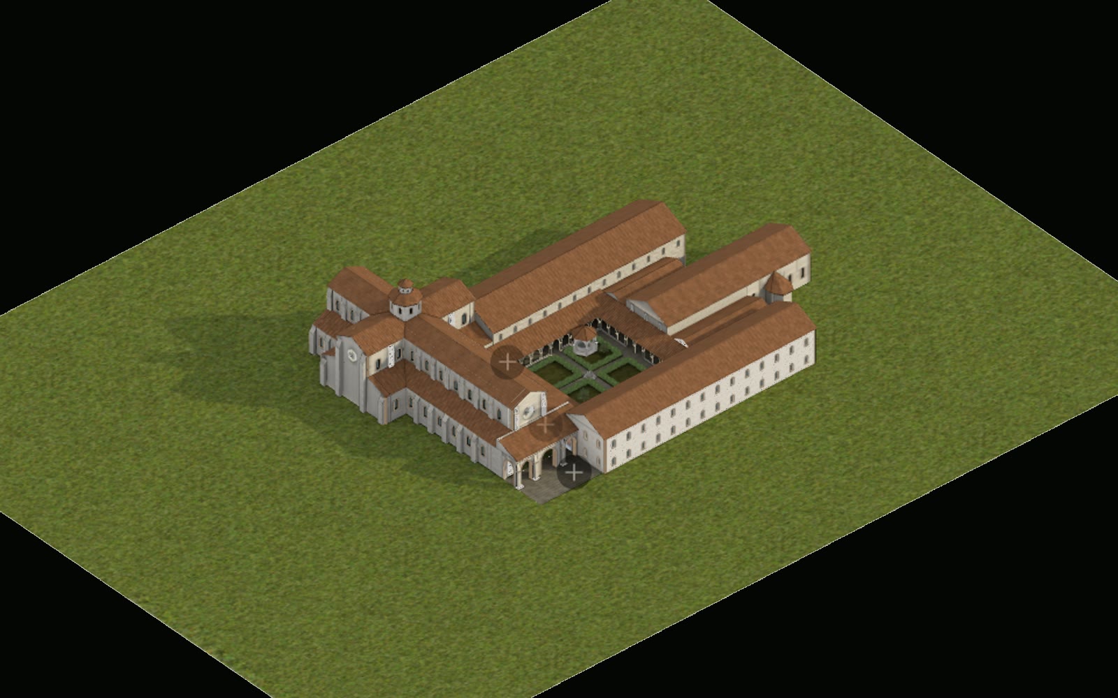
With architectural historians we then rebuilt the abbey in 3D as it probably stood originally. The reconstruction is published on our web platform DualData: rooms, corridors, cloisters and church can be visited from the browser, with historical notes on the points of interest.
The numbers
Accuracy of ±3 mm across the whole complex. 95% site coverage, including areas never documented before that the drone reached. Detail down to 2 mm, enough to tell apart the chisel marks on the stone. All outputs are georeferenced to the regional cartography and delivered in standard formats for archiving.
What it is used for today
The heritage authority uses the documentation as its conservation reference: it can compare the state of the building over time and design interventions on the survey rather than on estimates. The web reconstruction is used by researchers, students and anyone curious who cannot get to the abbey, and for a site with limited access that matters.
Accessibility
The reconstruction lives in the browser to remove a physical barrier; raising a digital one would defeat the point. We built it to WCAG 2.1 AA and the European EN 301 549 standard: every point of interest is reachable by keyboard and with assistive technology, the notes and guided paths describe through a screen reader what the 3D shows, contrast meets level AA with scalable type and no information carried by colour alone, animations respect the "reduce motion" preference, and it all works on modest devices and connections, with markup and reading order that make sense for any input device.
Making heritage accessible, here, is a technical specification.